Setting Out and Surveying – The Best Tools, Instruments, and Software Needed
Contents
- 1 Introduction
- 2 Setting Out and Surveying: A Preamble
- 3 Understanding Precision and Accuracy in Setting Out and Surveying
- 4 Choosing the Right Tools and Instruments
- 5 Comprehensive List of Tools, Instruments, and Software
- 5.1 Tools and Instruments
- 5.2 Comprehensive List of Software and Smartphone/Tablet Apps Used in Civil Engineering, Construction Surveying
- 5.2.1 Software
- 5.2.2 1. AutoCAD
- 5.2.3 2. Revit
- 5.2.4 3. Civil 3D
- 5.2.5 4. ArcGIS
- 5.2.6 5. SketchUp
- 5.2.7 6. Primavera P6
- 5.2.8 7. MicroStation
- 5.2.9 8. Staad.Pro
- 5.2.10 9. ProjectWise
- 5.2.11 10. MATLAB
- 5.2.12 Apps
- 5.2.13 1. Fieldwire
- 5.2.14 2. Procore
- 5.2.15 3. PlanGrid
- 5.2.16 4. AutoCAD Mobile App
- 5.2.17 5. MagicPlan
- 5.2.18 6. iHandy Carpenter
- 5.2.19 7. Construction Master Pro
- 5.2.20 8. DroneDeploy
- 5.2.21 9. Safety Meeting App
- 5.2.22 10. Buildertrend
- 5.3 Frequently Asked Questions (FAQs)
- 5.4 Conclusion
Introduction
Setting out and surveying serve as the fundamental pillars that ensure the robustness and success of various projects. As someone who has devoted considerable time to exploring this sphere, I am thrilled to delve deep into the essentials of setting out, surveying, tools, instruments, and software in the UK’s construction environment. Through this extensive guide, let us embark on a journey to unfold the intricacies and nuances that lie within this pivotal phase of construction.
Setting Out and Surveying: A Preamble
Before continuing, it’s better to explain the important role of setting out and surveying in the construction industry. These processes involve meticulously delineating the coordinates and levels on the ground, taken from the construction plans to aid in accurate construction development. In doing so, we lean heavily on a combination of tools, instruments, and software that streamline these processes and ensure impeccable results.
Understanding Precision and Accuracy in Setting Out and Surveying
In the bustling world of UK construction, the concepts of setting out and surveying are foundational to the successful initiation and completion of any project. More specifically, the twin pillars of precision and accuracy are paramount. Though sometimes swapped or confused, these terms possess nuanced differences that demand our attention and understanding.
Precision: The Harmony of Measurements
In setting out and surveying, precision echoes the harmonious agreement amongst a series of measurements conducted under similar circumstances. A high degree of precision indicates a lesser variance among these measurements, creating a tightly-knit grouping of data points. However, it’s critical to note that high precision doesn’t necessarily imply that these measurements are close to the true or accepted value. It only mirrors the consistency between individual measurements.
To illustrate this, let’s consider an instance where a team is involved in setting out the foundation for a new building. If the team uses a GPS-RTK instrument to measure a specific distance multiple times and receives values of 100.5m, 100.4m, and 100.5m, this represents high precision as the measurements are closely aligned. Yet, without validation against a known standard, the accuracy of these measurements remains unconfirmed.
Accuracy: The Pursuit of Truth
On the other hand, accuracy in the realms of setting out and surveying signifies the closeness of a particular measurement to a known, standardized, or true value. An accurate measurement aligns well with the accepted or true value, helping in delineating precise geographical and structural outlines necessary for construction projects.
For instance, if the accepted standard or true value for the above-mentioned distance is 100.0m, even though the team achieved high precision with their measurements (100.5m, 100.4m, 100.5m), they lack accuracy since the measurements are not close to the true value of 100.0m.
Merging Precision and Accuracy: A Balanced Approach
In the grand scheme of UK construction setting out, both precision and accuracy hold their own significance. Achieving a balance between these two can often lead to successful and error-free projects. Professionals must ensure the use of tools and instruments that not only facilitate repeated measurements with minimal variance but also align closely with known or accepted standards.
In this diagram, we encapsulate the essence of setting out and surveying branching into two pivotal components – precision and accuracy. Further, we delve into what each term entails, culminating in practical examples to provide a complete perspective.
Understanding the nuanced differences between these two terms and applying this knowledge during the selection of appropriate tools, instruments, and software, not only facilitate an efficient working process but pave the way for a successful project outcome. Armed with this knowledge, professionals are better equipped to navigate the complex landscape of UK construction setting out, fostering projects that stand tall, both in structure and in stature.
Choosing the Right Tools and Instruments
This process is modulated by various factors, each playing a vital role in influencing the ultimate choice of tools and instruments. To make an informed decision, it’s essential to dissect these factors in detail. Let’s explore each one:
Project Requirements:
Scale of the Project:
Different scales dictate the necessity for different sets of tools and instruments. For instance, expansive, large-scale projects typically require more comprehensive and sophisticated equipment, including state-of-the-art GPS instruments that provide precise measurements and mapping capabilities. On the other hand, smaller, more compact projects might only necessitate basic instruments such as theodolites or levelling staff, which offer simplicity and effectiveness without a hefty price tag.
Complexity of the Project:
Projects that boast intricate and detailed designs often call for advanced tools that have capabilities stretching to 3D modelling and other high-tech features. These tools can seamlessly navigate the complex landscapes, providing data that is both rich and detailed, thereby facilitating a smoother construction process.
Budget:
A pivotal aspect to consider is the budget allocated for the project. It is of utmost importance to strike a harmonious balance between the financial constraints of the project and the demand for high precision and accuracy. This delicate equilibrium ensures that the project does not compromise on quality while adhering to a budget. Moreover, it’s often a wise strategy to invest in top-notch instruments from the get-go, as these can prevent costly errors and reworks in the long run, thereby offering a higher return on investment.
Skill Level of the Operators:
Regardless of the sophistication of the tools at hand, the skill level of the individuals operating these instruments remains a crucial aspect. It’s paramount to ensure that your team is adeptly trained to handle the selected instruments, fostering a culture of precision and accuracy in every facet of the project. Additionally, certain tools and technologies demand a level of specialized expertise for effective utilization. Hence, investing in training programs might be a prudent decision to enhance the overall efficiency and success of the project.
Types of Surveys:
Lastly, the kind of survey or setting out being undertaken dictates the choice of tools and instruments. Different survey categories, ranging from topographic surveys to building setting outs, command unique sets of tools that are tailored to meet the specific requirements of each survey type.
Comprehensive List of Tools, Instruments, and Software
This section is a complete list of the extensive inventory necessary for proficient setting out and surveying, coupled with insightful mermaid diagrams to elucidate their functionalities.
Tools and Instruments
1. Measuring Tapes: These are fundamental tools in surveying and setting out the process, used extensively for measuring distances with utmost precision. Typically made of flexible materials, they allow surveyors to obtain accurate measurements over uneven terrain.

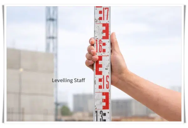
2. Levelling Staff: An invaluable companion to levelling instruments, levelling staff assists professionals in accurately gauging differences in elevation across a site. It generally comes marked with measurements to facilitate precise readings.
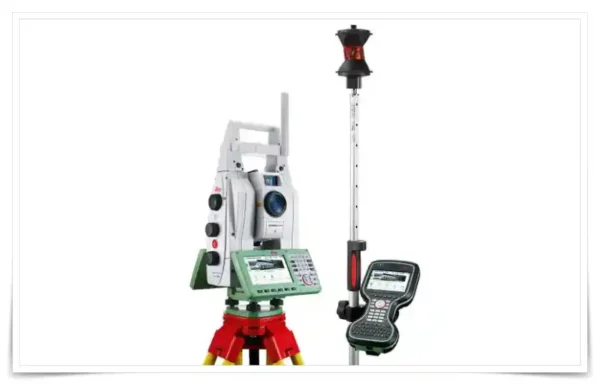
3. Total Station: An embodiment of technological advancement in the field, the total station integrates the functionalities of an electronic theodolite and distance-measuring equipment. This fusion results in a tool that offers impeccable accuracy and streamlined data collection processes, a true asset in modern construction settings.
Robotic Total Stations:
Robotic total stations are equipped with motorized mechanisms that allow them to automatically track a prism or a target. They can be operated by a single surveyor, as they can lock onto and follow the surveying rod or prism, making data collection more efficient.
Manual Total Stations:
Manual total stations require a surveyor or operator to manually aim the instrument at the target or point of interest. They do not have the automated tracking capabilities of robotic total stations.
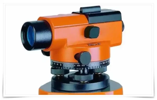
4. Auto Level: An auto level is a high-tech surveying instrument vital for establishing level points or measuring the height of land surfaces. It consists of a telescope mounted on a tripod and is equipped with an internal compensator that auto-corrects any deviations, ensuring a perfectly leveled line of sight. It is especially useful in construction projects where precision is paramount, but it demands more expertise to operate and adjust compared to simpler instruments.
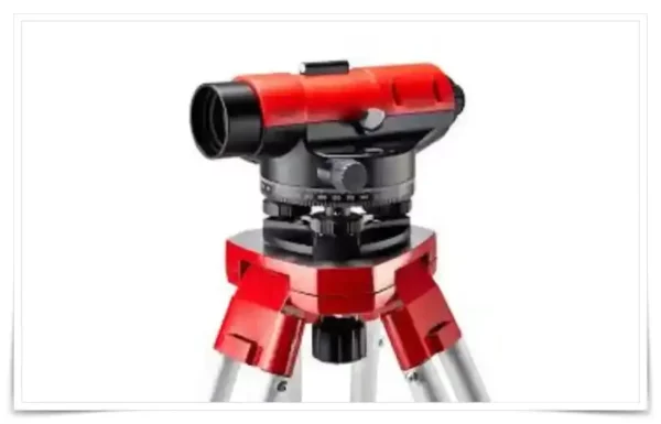
5. Dumpy Level: This is a more basic, yet powerful tool used frequently in surveying. Known for its simplicity and optical power, it is easier to handle with fewer adjustments required. However, its usage necessitates more manual precision and doesn’t provide automatic error correction like the auto level. It is most suitable for projects where ease of use and accurate readings are essential without the need for complex adjustments.
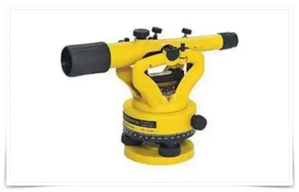
6. Transit Level: Transit levels are an advanced surveying instrument that combines the features of a theodolite and a dumpy level. Mounted on a tripod, it features a built-in spirit level within the telescope, aiding in the precise measurement of both horizontal and vertical angles, and distances. In construction and building projects, it serves to establish reference lines and provide exact angle readings, ensuring accurate alignment and levelling of structures.
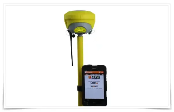
7. GPS – RTK Receiver: A cornerstone of modern surveying, GPS receivers are electronic devices that interact with satellites from various global navigation systems to pinpoint exact locations on Earth. They are critical in surveying to establish precise coordinates, which form the backbone of accurate mapping and planning.
Real-Time Kinematics (RTK), is a groundbreaking technology that enhances GPS accuracy to centimetre levels in real-time. By utilizing a correction stream alongside standard signals from global navigation satellite systems, it achieves remarkable positional accuracy at high frequencies. Previously a luxury for professional surveyors, it is now becoming increasingly accessible, revolutionizing accuracy in modern surveying operations.
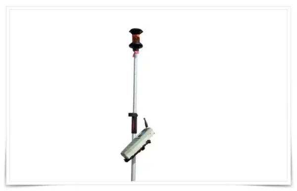
8. Prism and Pole: These are essential tools used in surveying to measure distances and facilitate the reflection of signals from surveying instruments. The prism, mounted on a pole, reflects signals back to the surveyor, enabling accurate distance measurements, crucial in mapping and planning.
The prism and pole are basically used for receiving the signal from the total station, for positioning and levelling.
9. Plumb Bob: A simple yet indispensable tool, the plumb bob helps in establishing vertical reference lines. By hanging the weighted object from a point, surveyors can measure verticality or alignment with respect to gravity, critical in structural and engineering surveys.

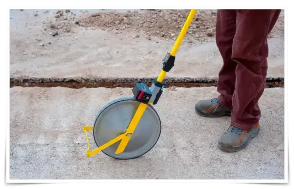
10. Surveyor’s Wheel: A surveyor’s wheel is a practical tool utilized for ground distance measurement. Consisting of a wheel attached to a handle, it measures the distance by rolling along the path under assessment. It serves as an invaluable tool in various surveying scenarios, including road construction and land measurement, allowing for rapid yet accurate distance assessments.
11. Levelling Plate: A levelling plate serves as a stable base for various levelling instruments such as auto levels or theodolites. Offering a reference surface ensures that measurements taken are accurate, preventing errors due to uneven grounding. It is particularly useful in terrains with uneven surfaces, ensuring that the instruments remain stable and level during the surveying process.

12. Pegs and Nails: These are fundamental accessories used to mark survey points and secure measurement instruments to the ground. Whether wooden or metal, they serve as temporary markers that assist in delineating boundaries or points of interest during a survey, facilitating organized and efficient data collection.

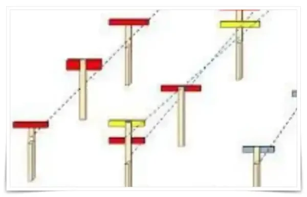
13. The Profile Board: Profile boards are typically constructed from durable materials for long-lasting use. One common design involves using thin steel plates welded to short sections of metal tubing, allowing them to slide up and down as needed. These adjustable profile boards can then be clamped onto a metal ranging rod for stability and accuracy.
A commonly preferred size for these metal profile boards is approximately 40 cm in length and 10 cm in width. To enhance visibility and ease of use, they are often painted in a distinctive red color.
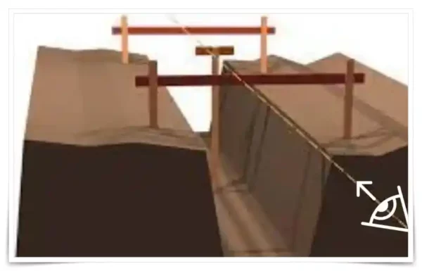
14. The Traveler: The Traveller also referred to as the “travelling profile” or “traveller,” is a crucial component in the realm of excavation control. It serves as a third profile board with a set height, designed to oversee and regulate the excavated levels between the two adjustable profile boards. When excavating along the prescribed path, from point A to point B, the traveller plays a pivotal role in ensuring that the desired levels are attained.
By positioning the traveller within the line of sight connecting points A and B, it becomes a straightforward process to ascertain the accuracy of the excavation work. If the top of the traveller falls below the sight line established by the two fixed profile boards, it indicates that the ditch has been excavated to a level lower than required. Conversely, if the traveller protrudes above the sight line, it signals the need for further digging to reach the desired depth. In essence, the traveller acts as a visual aid and quality control tool, facilitating precise excavation operations.
15. Markers and Paint: Markers and paint are essential in denoting measurements and reference points on the ground. These markings serve as a visual guide and a permanent reference during and after surveying operations, assisting in the delineation and demarcation of land or construction projects.

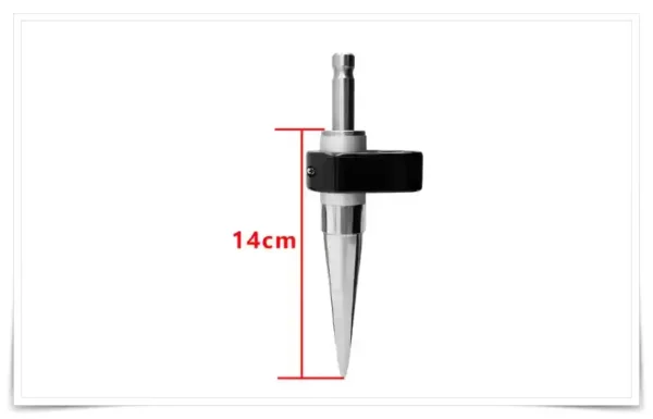
16. 14CM Mini prism pole for total station: It is usually useful when setting out at road kerbs or tall structures like capping beams, and using a tall prism pole is impossible.
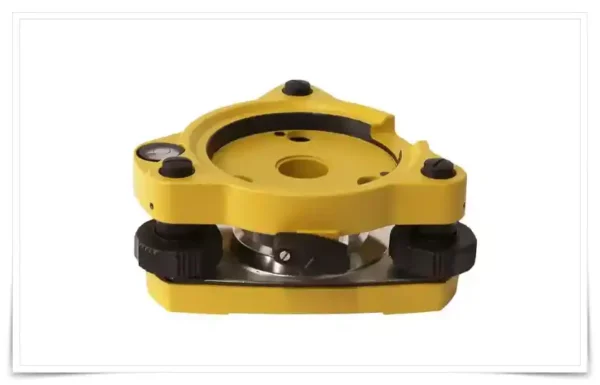
17. Tribrach: A tribrach is an accessory that facilitates the swift mounting and levelling of instruments like theodolites or total stations. Featuring three levelling screws, it aids in setting up the instruments quickly and precisely, saving time and reducing errors during the initial setup phase.
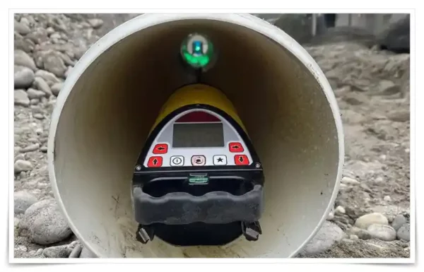
18. Pipe laser level: This device aids in aligning and levelling pipes, particularly during the installation of underground pipelines for sewage, drainage, and water systems. By projecting a straight laser beam, it ensures the correct gradient and alignment of pipes, facilitating more accurate and efficient installations in tunnels, roads, and other infrastructural developments. Its usage notably enhances the efficiency and accuracy of projects, making it a vital tool in the modern construction arena.
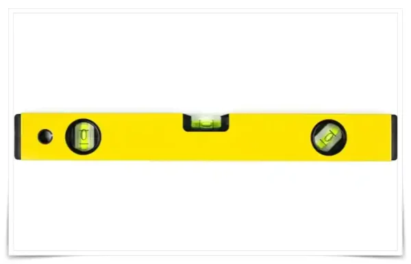
19. Spirit Level: A spirit level is a tool used in construction and woodworking to determine the horizontal levelness or vertical plumb of a surface or object. It consists of a slightly curved glass tube filled with a liquid (usually ethanol or a coloured spirit) and a bubble. When the bubble is centered between the two marked lines on the tube, it indicates that the surface is level (or plumb, in the case of checking verticality). Spirit levels come in various sizes and are commonly used in various tasks like hanging pictures, installing shelves, building furniture, and even in larger construction projects to ensure structures are built evenly and upright. It’s a vital tool in the toolkit of carpenters, builders, and DIY enthusiasts.
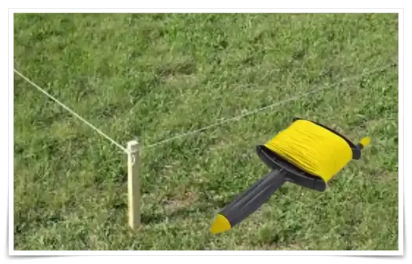
20. String Line: A string line is a tool often utilized in construction, landscaping, and various DIY projects. It consists of a tightly stretched string or cord, used to establish a straight line between two points. The string line is held taut and used as a visual and physical guide to ensure the alignment of structures or features, such as the straightness of walls, fences, or paving stones. It can be used in conjunction with other leveling tools, such as a spirit level or a line level (a small level that can be hung on the string) to verify that the line is not only straight but level or at the desired slope. It’s a simple yet invaluable tool for maintaining precision and uniformity in various building projects.
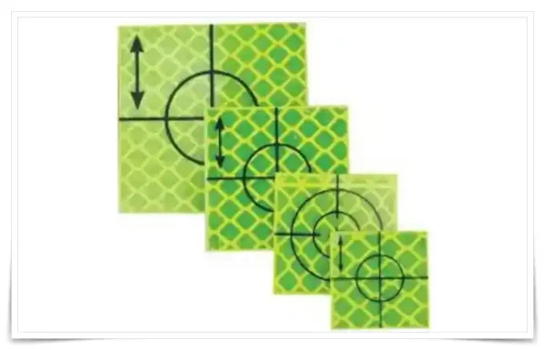
21. Retro Targets: Retro targets, also known as retroreflective targets, are markers used in surveying and construction that reflect light back to its source, allowing for precise positioning and measurement when utilized with laser scanning or optical measurement devices.
They are commonly used in land surveying and building construction to facilitate accurate measurements and alignments. Their reflective properties allow surveying instruments to quickly and precisely locate and measure points from a distance, enhancing the efficiency and accuracy of data collection in various geospatial applications.
22. Field Book and Pencils: A field book is where surveyors record measurements, sketches, and notes during fieldwork. Paired with pencils, which are preferred for their durability, this combination is central to data collection and record-keeping in surveying projects.

23. Calculator: Surveyors often require calculators for swift calculations involving distances, angles, levels, volumes, areas, gradients, and coordinates. This tool is vital for quick data processing in the field, aiding in the efficient progress of the surveying project.

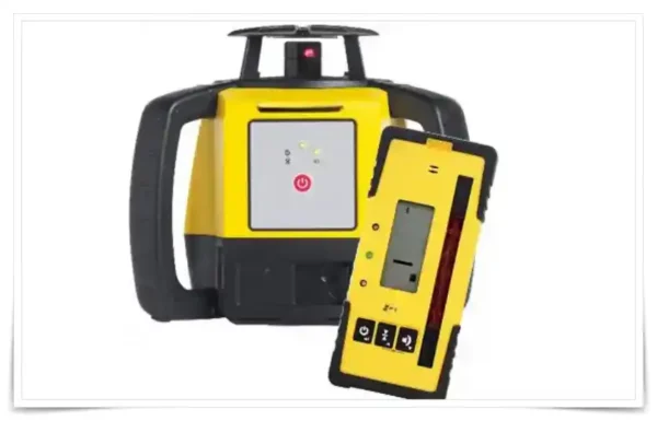
24. Rotary Laser Level: A laser level, a vital tool in construction and surveying, projects a laser beam for precise levelling and alignment. Its exceptional accuracy, often achieved through self-levelling mechanisms, minimizes human error, making it indispensable for tasks like setting concrete forms, aligning walls, or establishing reference points. With line, rotary, or dot configurations, it’s versatile, reducing effort and time while guaranteeing high-quality results in both indoor and outdoor settings.
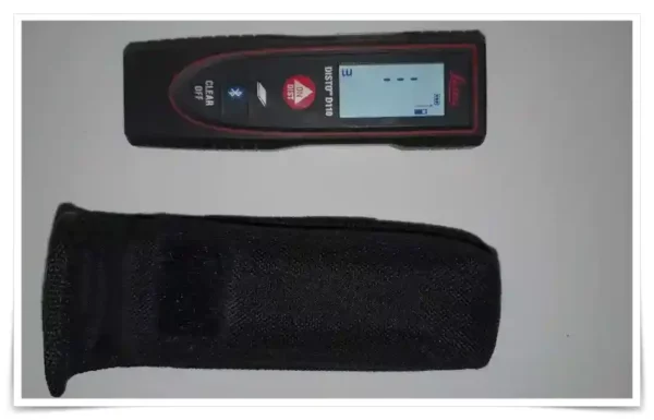
25. Laser Distance Measurer: A tool that uses laser technology for quick and accurate distance measurements. Particularly useful in modern surveying, it facilitates rapid data collection, helping to streamline the surveying process significantly.
26. Camera or Smartphone: These devices are used to document survey sites, capture images of survey points, and record visual information for future reference. They aid in creating a visual record of the site, which can be beneficial for analysis and reporting.

27. Data Collector: A data collector is a handheld device used to store and manage survey data collected in the field, usually by instruments like, total stations, GNSS, and 3D scanners. It digitalizes the data collection process, making it easier to organize, analyze, and retrieve data during and after the surveying process.

Comprehensive List of Software and Smartphone/Tablet Apps Used in Civil Engineering, Construction Surveying
These digital tools not only streamline workflow but also amplify accuracy and efficiency, making complex processes more manageable and precise. Below is an extensive list of software and applications that have been vital in reshaping the civil engineering and construction landscape:
Software

1. AutoCAD
Description: A premier drafting software developed by Autodesk, AutoCAD is widely used for 2D and 3D design and drafting. It offers a plethora of features that facilitate intricate detailing and blueprint creation. Application Areas: Creating detailed blueprints, site plans, and structural schematics for construction and civil engineering projects.
2. Revit
Description: Also developed by Autodesk, Revit is a Building Information Modeling (BIM) software, facilitating the design and management of building and infrastructure projects with real-time 3D visualization and collaboration capabilities. Application Areas: Developing complex building designs, coordinating construction models, and simulating project performance and documentation.
3. Civil 3D
Description: Tailored for civil engineering needs, Civil 3D offers tools for infrastructure design, analysis, and simulation, allowing professionals to assess different design options and optimize solutions. Application Areas: Road and highway design, land development, water and sewer line layout, and other civil infrastructure projects.
4. ArcGIS
Description: ArcGIS by Esri is a comprehensive mapping and analysis tool, offering advanced analytics and unique visualization capabilities. It is widely used in the field of geographic information systems (GIS). Application Areas: Urban planning, environmental impact assessment, geological surveying, and topographic mapping.
5. SketchUp
Description: SketchUp is a user-friendly 3D modeling software that allows engineers and architects to create and visualize their designs in three dimensions. Application Areas: Conceptual design phase, architectural visualization, landscape design, and interactive 3D presentations.
6. Primavera P6
Description: Primavera P6 is a project management software that aids in planning, scheduling, and controlling large-scale projects, offering tools for resource management and performance monitoring. Application Areas: Project planning and scheduling, risk management, resource allocation, and reporting in large construction and engineering projects.
7. MicroStation
Description: MicroStation is a CAD software providing robust tools for design, modeling, and visualization, facilitating the creation of detailed project deliverables. Application Areas: Infrastructure design and documentation, architectural modeling, and rendering for construction and engineering projects.
8. Staad.Pro
Description: Staad.Pro is a structural analysis and design software, offering features for the modeling and analysis of different types of structures made from various materials. Application Areas: Structural engineering, construction design, and analysis, including bridges, tunnels, and skyscrapers.
9. ProjectWise
Description: ProjectWise is a project collaboration and information software that facilitates the management of project data, coordination of teams, and integration of workflows. Application Areas: Project information management, workflow integration, and collaboration across multidisciplinary teams in infrastructure projects.
10. MATLAB
Description: MATLAB is a high-level programming language and interactive environment used for numerical computation, visualization, and programming. Application Areas: Data analysis, algorithm development, and simulation in civil engineering research and project development.
Apps

1. Fieldwire
Description: A project management app allowing professionals to manage workflow, create schedules, and collaborate in real-time. Application Areas: Task management, blueprint viewing, and reporting in construction projects.
2. Procore
Description: A comprehensive construction management software that facilitates project management, financials, and resource coordination on a unified platform. Application Areas: Project management, quality & safety control, financial management, and design coordination.
3. PlanGrid
Description: An application that allows for real-time collaboration, punch list management, and document storage in the cloud. Application Areas: Document management, construction drawing viewing, and project collaboration.
4. AutoCAD Mobile App
Description: This app brings the power of AutoCAD to your mobile device, enabling viewing, editing, and drafting on the go. Application Areas: Field inspection, construction site visits, and quick drafting tasks.
5. MagicPlan
Description: An app that helps in creating detailed floor plans using the camera of a smartphone or tablet. Application Areas: Floor plan creation, construction documentation, and estimating project costs.
6. iHandy Carpenter
Description: This app features a set of tools including a plumb bob, a surface level, and a bubble level bar, making it a handy toolkit for engineers and constructors. Application Areas: Quick on-site measurements, level checks, and angle measurements.
7. Construction Master Pro
Description: A construction calculator app offering a wide array of construction math and conversions. Application Areas: Construction math calculations, conversions, and construction layout tasks.
8. DroneDeploy
Description: An app that facilitates the capturing of high-resolution aerial images and 3D models using drones. Application Areas: Site surveys, progress tracking, and mapping in large construction projects.
9. Safety Meeting App
Description: An application that assists in documenting safety meeting details and incidents, ensuring compliance with safety regulations. Application Areas: Safety management, compliance documentation, and incident reporting in construction projects.
10. Buildertrend
Description: A construction management system that facilitates project management, customer service, and project scheduling on a cloud-based platform. Application Areas: Client management, project scheduling, and financial management in construction projects.
I am often met with queries regarding the finest tools available in the market, and how they can streamline complex processes making them more manageable and precise. To this end, I have delineated an extensive list that encompasses a broad spectrum of software and applications which are redefining the frontiers in the field of civil engineering and construction. These encompass the likes of AutoCAD, a veritable powerhouse in the drafting segment, to mobile applications like Fieldwire, which stands as a testament to the marvels of real-time project management and collaboration.
Frequently Asked Questions (FAQs)
Are these software and apps suitable for both beginners and professionals? Absolutely, these platforms have user-friendly interfaces and extensive help resources that make them accessible to both newcomers and veterans in the field.
How do these tools enhance precision and efficiency in construction projects? These tools offer features like real-time 3D visualization, cloud-based collaboration, and advanced analytics which significantly enhance accuracy and streamline workflows.
Are mobile applications as powerful as the desktop versions? In many cases, mobile applications offer similar functionalities as desktop versions, and the added advantage of accessibility, making it possible to perform critical tasks on-the-go.
How do these software and apps contribute to safety in construction sites? Safety-centric applications help in documenting safety meetings, tracking incidents, and ensuring compliance with safety regulations, thereby fostering a safer work environment.
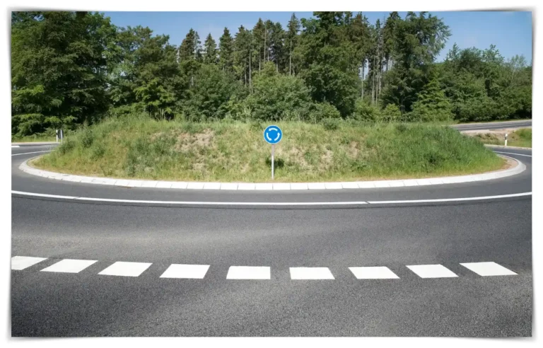
I invite you to read about the nuances of construction site engineering through other insightful pieces, such as “Construction Site Engineering-Starting a New Road Roundabout Project!”, which can be accessed here. Furthermore, I made a video about a part of my offered services in the U.K. Midlands in my YouTube channel, “🌐 Unraveling Land Survey Services 📐U.K. Midlands”, where I dissect several critical aspects in detail.
I eagerly await your thoughts on the matter. Your perspectives not only enrich the discourse but serve as vital inputs that foster a culture of knowledge-sharing and collaboration. Please, do not hesitate to leave a comment below sharing your experiences or insights regarding these tools.
Conclusion
In conclusion, I sincerely hope that this comprehensive guide serves as a beacon, illuminating the path towards a more technologically adept, and precision-driven future in the realms of civil engineering and construction. Do remember, the journey towards innovation is continuous and fueled by engagement and discourse.
Stay tuned for more insightful analyses and do engage with the rich repository of knowledge that this platform promises. Thank you for being a part of this journey!