Land Survey and Site Surveys: An Effective Comprehensive Guide
In the dynamic world of civil engineering, mastering the nuances of a site survey is not just beneficial, it’s necessary. As I guide you through this comprehensive look at effective site surveys, you’ll discover how technology and GIS play pivotal roles in ensuring project success. Let’s embark on this enlightening journey together.
Contents
- 1 Introduction
- 2 The Paramount Importance of Site Surveys and Land Surveys
- 2.1 Ensuring Property Boundaries
- 2.2 Land Development Planning
- 2.3 Property Transactions
- 2.4 Types of Land Surveys
- 2.5 Incorporating Advanced Technologies
- 2.5.1 Speed and Efficiency
- 2.5.2 Access to Remote Locations
- 2.5.3 High-Resolution Imagery and 3D Mapping
- 2.5.4 Environmental Analysis and Monitoring
- 2.5.5 Detail and Precision
- 2.5.6 Stockpile Volume Determination
- 2.5.7 Enhanced Safety and Efficiency
- 2.5.8 Integration with Other Technologies
- 2.5.9 A Gateway to Sustainable Practices
- 2.5.10 A Fusion of Multiple Technologies
- 2.5.11 Enhancing Accuracy and Efficiency
- 2.5.12 A Dynamic Tool for Varied Landscapes
- 2.5.13 Integration with CAD Drawing and Reporting
- 2.5.14 Sustainable and Environmentally Friendly
- 2.6
- 3 The Evolution of Site Survey Technology
- 3.1 Harnessing the Power of Innovation
- 3.2 Case Study: New Technology vs. Traditional Methods in Site Survey
- 3.3 Documentation: The Backbone of a Successful Survey
- 3.4 Fostering Precision through CAD Drawings
- 3.5 The Role of Reports in Land Surveys
- 3.6 Stockpile Volume Determination: An Essential Component
- 3.7 FAQs
- 3.8 Conclusion
- 3.9 Call to Action
- 3.10 Additional Resources
Introduction
In an era where precision is key, taking an informed step forward has never been more vital. Be it in real estate, construction, or land development, the cornerstone to informed decision-making lies in meticulous site surveys and land surveys. Equipped with state-of-the-art technology and an immense repository of expertise, our team stands ready to guide you through this fundamental process, ensuring your journey from the drawing board to reality is seamless, accurate, and efficient.
As we embark on this enlightening journey together, I am here to navigate you through the labyrinthine world of site surveys and land development. In this comprehensive guide, we will delve deep into the significance of site surveys, the cutting-edge technology that powers it, and the importance of accurate documentation. From the nuances of CAD drawing to generating a detailed report that can be a beacon for your project, we’ve covered it all.
Here’s a glimpse of what awaits you in this guide:
- The unerring significance of site and land surveys in today’s world.
- A peek into the evolution of survey technology that’s revolutionizing the industry.
- Documentation – the linchpin holding all survey processes together.
- CAD drawing and report generation – an in-depth exploration.
- A real-world case study illuminating the principles discussed in the guide.
Additionally, I will address frequently asked questions to quell any curiosities or concerns you may have about the site survey process. I also encourage you to engage with our community by leaving a comment, sharing your insights, or asking questions that you might have. It is my utmost desire to make this space a collaborative learning hub, enriched with shared knowledge and experiences.
Now, without further ado, let’s unravel the layers of site survey and land survey processes, step by well-informed step. Let’s forge a path that melds technology, expertise, and foresight into a roadmap for success in your upcoming ventures.
The Paramount Importance of Site Surveys and Land Surveys
Ensuring Property Boundaries
Understanding the importance of site surveys begins with recognising their role in defining property boundaries clearly. Site surveys use the most recent GPS and GIS technology to create detailed and exact boundary maps, thus preventing costly and time-consuming boundary disputes. When venturing into land transactions or development planning, such a survey serves as a foundation stone, a necessity before any groundwork begins.
Land Development Planning
When it comes to land development, having a comprehensive land survey in place is not an option but a prerequisite. It sheds light on vital aspects such as topography, existing structures, and utilities. This information, documented meticulously in a technology-driven report, helps developers avoid unforeseen complications, paving the way for smooth project execution. With the assistance of CAD drawing technology, this data can be visualized, allowing for more informed decision-making processes.
Property Transactions
Navigating property transactions requires a keen eye for detail, where every facet of the property needs to be documented meticulously. A well-executed site survey serves this purpose, offering both buyers and sellers a clear picture of the property’s characteristics, including any potential encroachments or easements. This meticulous documentation forms the basis of transparent and smooth transactions, fostering trust and reliability among stakeholders.
Types of Land Surveys
In my journey, I have specialized in offering a diverse range of land survey types, each tailored to meet specific needs. From boundary surveys that employ advanced techniques to topographic surveys crafting detailed maps of land surfaces, I provide a comprehensive suite of services. Let me guide you through some of the main types of land surveys I specialize in:

Boundary Surveys: This is where I employ advanced techniques and technology to delineate property lines with utmost accuracy, providing detailed and trustworthy boundary markers that prevent disputes.
Topographic Surveys: My team and I meticulously craft detailed maps showcasing the land’s natural and man-made features, serving as a critical tool for construction and land development projects.
ALTA/NSPS Land Title Surveys: These are quintessential for commercial real estate transactions, providing a detailed analysis of property boundaries, improvements, and encumbrances, aligned with the rigorous ALTA/NSPS standards.
Construction Layout Surveys: Here, I ensure that your construction projects materialize according to the designed plan, minimizing errors and fostering efficiency throughout the construction process.
Stockpile Volume Determination – An Overview
As I navigate through various projects, I often find myself immersed in the meticulous process of determining stockpile volumes. This is an essential component in site surveys, especially when we talk about construction and mining sectors. Here, let me elucidate the process and its undeniable significance:
Stockpile volume determination is a method employed to calculate the volume and mass of materials stored in stockpiles accurately. This is pivotal in managing inventories, planning procurement strategies, and ensuring that project timelines are met without any hitches. In my practice, I utilize advanced technology such as GPS-RTK instruments, drones and 3D laser scanning to capture high-resolution images, which are then processed to generate a precise CAD drawing and report documenting the volume and condition of the stockpile.
Please visit my services website page!
Incorporating Advanced Technologies
During the process, I rely heavily on integrating the latest technologies to facilitate a seamless and accurate determination of stockpile volumes. Here are the primary technologies I employ:
- UAVs (Unmanned Aerial Vehicles) /Drones:
In the ever-evolving field of site survey and land survey technology, UAVs, also known as drones, have become pivotal tools in the armory of modern surveyors. These unmanned aerial vehicles are equipped with high-resolution cameras and GPS technology, facilitating the collection of accurate data points during topographic surveys.
Speed and Efficiency
Utilizing drones, I have been able to expedite the site survey process significantly. The ability of drones to cover large areas in a fraction of the time compared to traditional methods means that projects can move forward at a quicker pace, saving time and resources. Drones can swiftly map out large areas, providing real-time data that can be used to make informed decisions swiftly.
Access to Remote Locations
Drones and other UAVs have revolutionized how we approach site surveys, especially in regions that are traditionally challenging to access. From steep terrains to swampy areas, UAVs can navigate these spaces with ease, ensuring that no stone is left unturned during the survey. This has been particularly beneficial in projects where safety and accessibility were paramount concerns, allowing for a comprehensive site survey without putting human lives at risk.
High-Resolution Imagery and 3D Mapping
Beyond speed and accessibility, drones are equipped with technologies that allow for high-resolution imagery and 3D mapping. The detailed aerial imagery aids in creating accurate CAD drawings and reports, which are pivotal in planning and executing development projects. As someone who has firsthand experience utilizing these technologies, I can vouch for the level of detail and accuracy that drones can provide, revolutionizing the way we perceive and document land and its features.
Environmental Analysis and Monitoring
UAVs have also found utility in environmental monitoring, a crucial component in today’s site surveys. They can monitor environmental changes over time, assisting in sustainable planning and development. Utilizing drones, surveyors like myself can closely monitor various environmental factors, providing a detailed report that can guide eco-friendly development strategies.
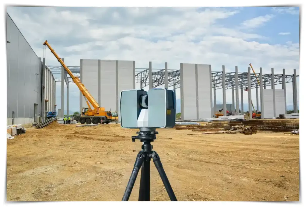
2. 3D Laser Scanning:
Among these, 3D laser scanning stands as a beacon of innovation, revolutionizing the manner in which we approach land and site surveys. Here, I delve deeper into why 3D laser scanning has become an invaluable tool in my practice.
Detail and Precision
As someone deeply entrenched in the field, I cannot emphasize enough the level of detail and precision that 3D laser scanning brings to the table. It facilitates the creation of detailed and accurate three-dimensional models, especially of stockpiles, allowing for precise volume calculations that are vital in various industries such as construction, mining, and urban planning.
Stockpile Volume Determination
In the realm of site surveys, stockpile volume determination is a crucial task. Through 3D laser scanning, I have been able to achieve a nuanced view of stockpile structures, facilitating a meticulous documentation process. This technology enables the capture of complex data points that paint a comprehensive picture, aiding in more accurate volume determinations which are crucial for project planning and inventory management.
Enhanced Safety and Efficiency
Adopting 3D laser scanning has not only improved the quality of the data collected but has also significantly enhanced the safety protocols during site surveys. This non-intrusive method of data collection ensures that personnel can conduct surveys from a safe distance, especially in potentially hazardous environments. Furthermore, the speed at which data can be collected enhances efficiency, allowing for quicker turnover times and project advancement.
Integration with Other Technologies
3D laser scanning has seamlessly integrated with other advanced technologies such as CAD drawing and Geographic Information Systems (GIS). This synergy allows for the creation of detailed and layered reports, which serve as a robust foundation for informed decision-making. In my experience, the ability to integrate laser scanning data into comprehensive documentation and technology systems has been a game-changer, offering a holistic view that is indispensable in today’s dynamic project environments.
A Gateway to Sustainable Practices
In my pursuit to foster sustainable practices, I have found 3D laser scanning to be a vital ally. By facilitating accurate data collection, it assists in optimizing material usage and minimizing waste, thus promoting sustainability in the projects I undertake. Moreover, it plays a significant role in environmental conservation, as it allows for the meticulous planning of land usage, and safeguarding natural habitats and ecosystems.
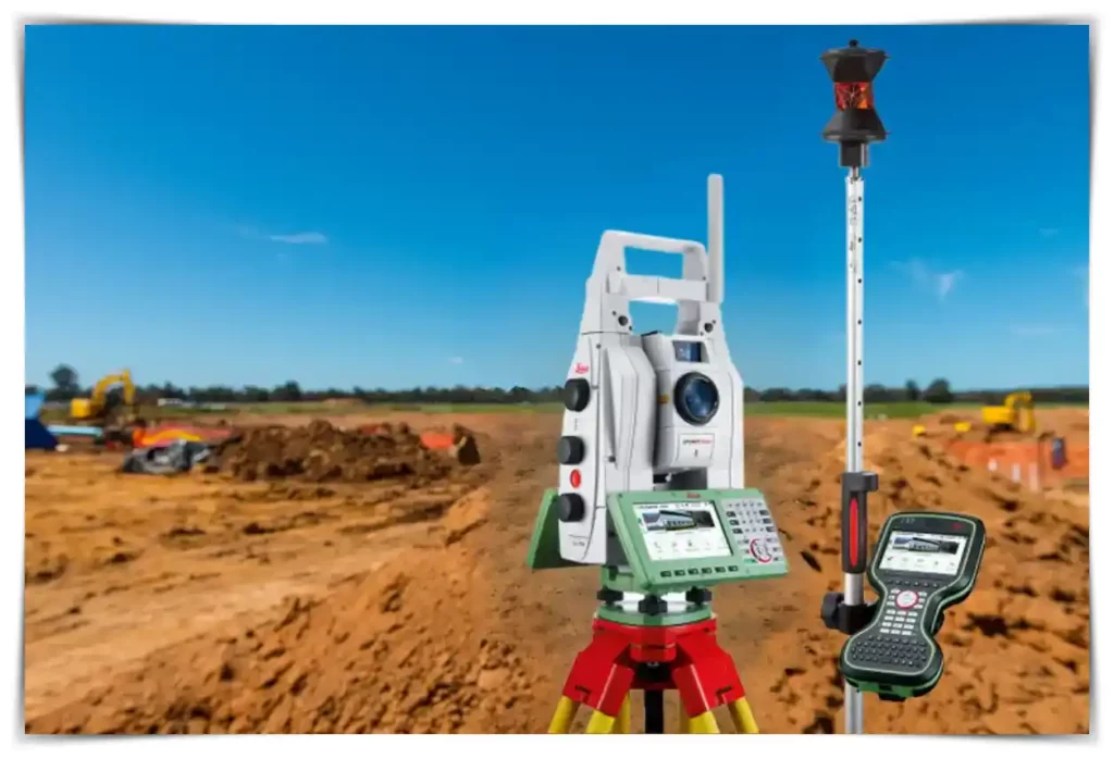
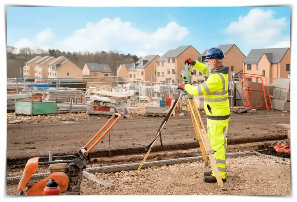
3. Total Station: The Heart of Modern Site Surveys
In the ever-evolving sphere of site survey and land survey, the introduction of the total station has been nothing short of a watershed moment. A pivotal instrument in my toolkit, the total station stands as a testament to the heights technology has reached, revolutionizing the way we approach surveys today. Allow me to guide you through the intricacies of this remarkable instrument that has fundamentally transformed the surveying landscape.
A Fusion of Multiple Technologies
The total station is a versatile digital instrument that embodies the convergence of various technologies. It synergizes the functionalities of a theodolite with electronic distance measurement (EDM) capabilities, allowing surveyors like me to measure angles and distances with unparalleled precision. This potent combination facilitates the meticulous mapping of the heights and distances of different elements within a landmass, whether they are natural formations or man-made structures.
Enhancing Accuracy and Efficiency
As someone committed to delivering precise and reliable results, I find the total station to be an invaluable ally. It dramatically enhances the accuracy of data collected during site surveys, reducing the margin of error to a negligible minimum. Moreover, it significantly expedites the survey process, allowing for a swift and efficient data collection phase, which is essential in meeting project timelines and ensuring client satisfaction.
A Dynamic Tool for Varied Landscapes
The versatility of the total station comes to the fore when tasked with mapping diverse landscapes. It effortlessly accommodates the varied contours and elements found in different landmasses, from the undulating terrains of natural landscapes to the structured environs of urban settings. This adaptability makes it a favored instrument in my practice, capable of delivering impeccable results in diverse project settings.
Integration with CAD Drawing and Reporting
One of the highlights of using a total station is its seamless integration with advanced documentation technologies like CAD drawing. This integration enables the creation of detailed and accurate site maps and reports, serving as a robust documentation backbone that aids in informed decision-making. Through this synergy, I can create comprehensive site survey reports that serve as a blueprint for successful project execution.
Sustainable and Environmentally Friendly
In my endeavor to promote environmentally conscious practices, the total station emerges as a potent tool. Its precise data collection capabilities minimize the need for invasive survey methods, thus preserving the natural integrity of the land. Moreover, it promotes sustainability by optimizing resource allocation and minimizing wastage during the construction and development phases.

4. Harnessing the Power of GNSS and GPS-RTK in Site Surveys
Navigating the complex terrains during land and site surveys has been revolutionized with the incorporation of GNSS (Global Navigation Satellite System) and GPS-RTK (Global Positioning System – Real-Time Kinematic) in my surveying arsenal. Here, I succinctly unravel the inherent benefits of these technologies and how they are reshaping the land survey landscape.
Accurate Positioning with GNSS
Utilizing GNSS, I have managed to hone the accuracy of pinpointing geographical locations during site surveys. The system leverages multiple satellite constellations, offering precise data for CAD drawing and report documentation, which is indispensable in contemporary land development projects.
GPS-RTK: Elevating Precision to the Next Level
Complementing GNSS, the GPS-RTK technology has proven to be a game-changer in site survey dynamics. Enabling real-time corrections, it aids in achieving centimeter-level accuracy. This unprecedented precision is particularly vital when meticulous detail is the cornerstone of a project, assuring every stakeholder in the chain of the project’s integrity and accuracy.
5. LiDAR in Modern Site Surveys: A Leap Towards Precision
In the ever-evolving landscape of site surveys, integrating advanced technologies is crucial. One such revolutionary tool is LiDAR, which stands for Light Detection and Ranging. This technology has significantly refined the way I conduct land surveys. Let me briefly guide you through the merits of adopting this innovative technology.
Quick and Detailed Data Acquisition
LiDAR operates by using near-infrared lasers to measure distances on the Earth’s surface. It can quickly generate longitudinal, latitudinal, and height data of an area, offering a rich, detailed perspective that forms a vital part of the documentation process, particularly in CAD drawing and report generation.
Overcoming Territorial Challenges
What makes LiDAR an indispensable tool in my toolkit is its ability to reach areas where traditional survey methods falter. Whether surveying rugged terrains or densely vegetated areas, LiDAR provides detailed insights, expanding the scope of land surveys considerably.
Seamless Integration with Modern Techniques
In my experience, LiDAR harmonizes well with other current surveying technologies, including GNSS and robotic total stations. This harmony allows for a comprehensive approach to site surveys, delivering detailed and accurate results in a time-efficient manner.


The Evolution of Site Survey Technology
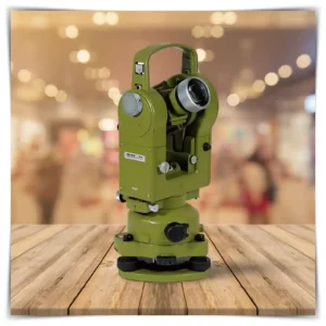
In my extensive journey through the realms of site surveys and land surveys, I have witnessed a transformative shift that technology has brought about in this domain. It is as if every stride in technology has echoed manifold advancements in the techniques and methodologies applied in site surveys. Let me take you through a deep dive into how technology has been a beacon, steering the evolution of site surveys into an era of unparalleled accuracy and efficiency. Think bout! I started 20 years ago, with an old theodolite for angle measurements like this one!
Harnessing the Power of Innovation
In the early stages of my career, the primary tools at my disposal were traditional surveying instruments such as theodolites and tape measures. While these tools served their purpose, the introduction of advanced technologies like GPS, GIS, and drone technology revolutionized the field, offering a level of detail and precision that was previously unattainable.
Take, for example, the integration of Geographical Information Systems (GIS) in site surveys. GIS technology has enabled us to visualize, question, analyze, and interpret data to understand relationships, patterns, and trends in the land and infrastructure. This has proven to be a game-changer, especially in urban planning and environmental management.
Furthermore, the advent of Computer-Aided Design (CAD) has allowed for the creation of detailed, multi-dimensional drawings and reports, making the documentation process more streamlined and efficient.
Case Study: New Technology vs. Traditional Methods in Site Survey
Introduction
In the ever-evolving field of land surveying, the adoption of new technology has the potential to revolutionize traditional surveying methods. This case study explores the advantages and disadvantages of using new technology versus old-fashioned methods in site surveys by comparing two approaches used by a fictional land surveying company, Modern Surveys, Inc.
Background
Modern Surveys, Inc. is a reputable land surveying company with a history of successful projects using conventional surveying techniques. However, in recent years, they have faced increased competition and client demands for quicker and more accurate results. To address these challenges, the company decided to explore the use of modern technology in their surveying processes.
The Traditional Approach
Traditionally, Modern Surveys relied on total stations, theodolites, and manual field measurements. Surveyors would spend significant time on-site, taking precise measurements and recording data manually. This approach was known for its accuracy but was time-consuming and required extensive fieldwork.
The New Technology Approach
Modern Surveys decided to implement Global Positioning System (GPS) and Geographic Information System (GIS) technologies in their surveying projects. With GPS receivers, surveyors could collect data faster and more efficiently, reducing the need for extensive fieldwork. GIS allowed for real-time data analysis and mapping, improving the accuracy of their final reports.
Comparative Analysis
Accuracy:
- Traditional: Traditional methods were renowned for their accuracy, especially in challenging terrain or densely populated areas.
- New Technology: While GPS and GIS provided excellent accuracy, they were susceptible to signal interference in urban canyons or dense tree cover.
Speed:
- Traditional: The traditional approach required more time on-site due to manual data collection and calculations.
- New Technology: New technology significantly reduced fieldwork time, allowing for quicker project turnaround.
Cost:
- Traditional: Traditional methods often required a larger workforce and more equipment, leading to higher project costs.
- New Technology: The implementation of GPS and GIS had an initial cost but reduced labor and equipment expenses in the long run.
Environmental Impact:
- Traditional: The traditional approach sometimes involved disturbing the environment with extensive on-site activities.
- New Technology: New technology reduced on-site disturbance as surveyors spent less time in the field.
Conclusion
Modern Surveys, Inc. experienced a notable shift in their surveying operations by embracing new technology. While traditional methods remained the gold standard for accuracy, the adoption of GPS and GIS technologies provided faster results, cost savings, and reduced environmental impact.
The choice between new technology and traditional methods ultimately depends on the specific project requirements, location, budget constraints, and client expectations. Modern Surveys now have the flexibility to select the most appropriate approach based on these factors, ensuring that they remain competitive and capable of delivering high-quality surveying services in a rapidly changing industry.
Documentation: The Backbone of a Successful Survey
In the past I have come to regard documentation as not just a requirement, but indeed the backbone of any successful site survey project. From the initial stages of mapping out the CAD drawings to the final report compilation, every step is meticulously recorded and archived. This practice not only fosters transparency but also ensures that every intricate detail is captured, thus laying the groundwork for an impeccable land survey. Let’s delve into the nuanced realm of documentation that stands as a lynchpin in the success of any survey venture.
Fostering Precision through CAD Drawings
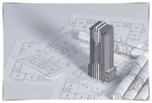
During the initial stages of a site survey, creating precise CAD drawings emerges as a fundamental step. CAD technology, in my experience, has been instrumental in providing a platform where intricate details can be documented with the highest degree of accuracy. Through these drawings, stakeholders can visualize the exact dimensions and layouts, making it a pivotal tool in land development planning.
I made a graphic representation as you understand better:
The Role of Reports in Land Surveys
A substantial part of documentation is culminating in a detailed report that encompasses every aspect of the survey. The reporting phase is a critical juncture where all collected data, analyses, and insights are compiled into a cohesive document. This report, crafted with meticulous attention to detail, serves as a repository of vital information, aiding stakeholders in making informed decisions regarding land use and development.
The documentation process, as envisioned in my practice, aligns with a well-structured framework that allows for a seamless transition from initial surveys to final reporting. Below is a representation of this framework:
Stockpile Volume Determination: An Essential Component
In land development and construction projects, the determination of stockpile volumes holds a pivotal role. It involves calculating the volume of materials needed or excavated, a process meticulously documented to avoid discrepancies and ensure an efficient workflow. With the aid of modern technology, this determination is executed with an unprecedented level of precision, forming a vital component of the documentation process.
The documentation process, as envisioned in my practice, aligns with a well-structured framework that allows for a seamless transition from initial surveys to final reporting. Below is a representation of this framework:
FAQs
In this section, I will answer some of the frequently asked questions pertaining to site surveys and land surveys, providing you with comprehensive insights into the world of surveying.
Why is documentation a critical aspect of site surveys? Documentation serves as a tangible record of all the data collected during the site survey, ensuring that every detail is captured accurately for future reference and analysis.
How do CAD drawings contribute to the documentation process? CAD drawings allow for the visualization of site-specific details in a highly accurate and detailed manner, facilitating more informed planning and decision-making.
What is the significance of stockpile volume determination in site surveys? Stockpile volume determination is crucial in managing and planning resource allocation during construction, ensuring that projects are executed efficiently with the correct amount of materials.
Conclusion
As we navigate through the intricacies of land and site surveys in this comprehensive guide, it becomes evident that the role of these surveys is paramount in the realms of real estate, construction, and land development. From ensuring precise property boundaries to aiding in efficient land development planning, these surveys are indispensable tools in the industry.
Call to Action
At the end of this enriching journey, I invite you to share your thoughts and experiences with us. Your engagement is not just welcomed, but deeply valued. Please leave a comment below and don’t hesitate to explore more articles on this platform to gain a comprehensive understanding of the subject. Together, let’s foster a community where knowledge meets experience.
Additional Resources
To further enrich your understanding of site surveys and land surveys, I have carefully curated a list of reputable resources that offer deep insights into this domain. Whether you are a veteran in the field or just getting started, these resources will provide you with a well-rounded perspective and practical knowledge to enhance your expertise:
Point to Point – Land Surveyors: This source delves deep into the intricacies of land surveying, offering insightful articles and case studies. Their wealth of resources is a valuable tool for anyone keen on exploring the depths of land survey documentation and practices.
TOPS (Take-off Professionals): A platform that presents the latest advancements in site survey technology, keeping you abreast of the industry trends and developments. As a professional, I often find the insights offered here to be pivotal in staying updated with the rapidly evolving technology in our field.
PTC – Digital Transforms Physical: From CAD drawing tutorials to documentation best practices, this resource is a treasure trove of information for professionals in the field. It has been a reliable companion in my journey, aiding in honing skills and understanding the nuances of CAD drawing and report creation.
Civil Engineering Journal: A comprehensive portal that offers a rich repository of reports and publications on various aspects of land surveys. The journal is a hub of scientifically-backed articles and studies, a go-to platform for those looking to delve into scholarly insights on-site survey dynamics.

