Soil Stockpile Volume Determination Survey
What is Soil Stockpile Volume Determination?
Soil stockpile volume determination is the process of measuring and calculating the volume of soil or other materials that have been stockpiled or accumulated at a specific location. This is a crucial task in various industries, including construction, mining, and environmental management. The primary purpose of soil stockpile volume determination is to:
Inventory Management: It helps in keeping track of the amount of soil or material available at a site. This is vital for project planning and ensuring that there is an adequate supply of material for ongoing work.
Resource Planning: By accurately determining the volume of soil in a stockpile, project managers can make informed decisions about when and how to use the material, whether it’s for construction, landscaping, or other purposes.
Cost Estimation: Knowing the volume of stockpiled soil allows for more accurate cost estimations, helping project managers budget and allocate resources effectively.
Compliance: Many environmental and regulatory agencies require accurate records of material stockpiles to ensure compliance with rules and regulations regarding environmental impact and land use.
1. Preparation:
a. Safety: I ensure that safety measures are in place, and the survey area is safe for my team to work in.
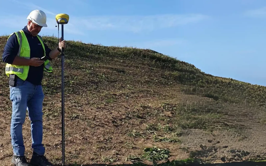
b. Equipment: I gather the necessary equipment, which typically includes surveying instruments like total stations, laser scanners, or GPS equipment, as well as safety gear and documentation tools.
2. Survey Procedure:
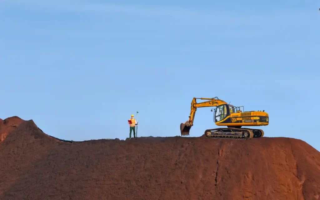
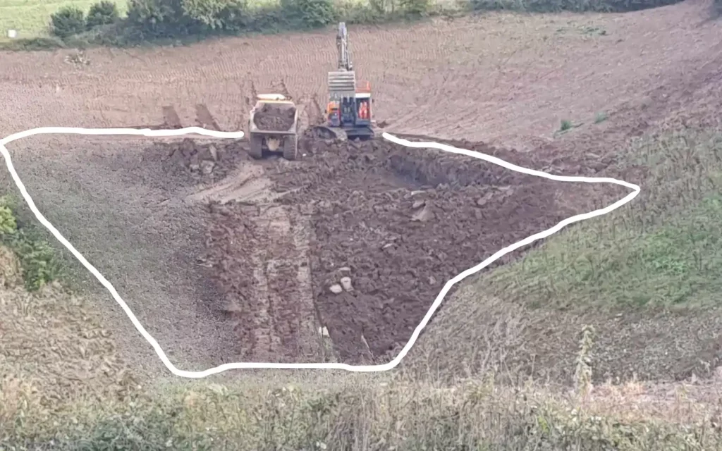
a. Establish Control Points: I establish the baseline, and the boundary around the stockpile area to provide a reference for my measurements.
b. Data Collection: I use my chosen surveying equipment to collect data points around the stockpile’s perimeter, at regular intervals or in a grid pattern, depending on the terrain.
c. Vertical Measurements: I measure the elevation of the stockpile surface at multiple locations to determine its shape and contour.
d. Data Processing: I process the collected data to create a 3D point cloud or surface model of the stockpile.
3. Volume Calculation:
a. Boundary Definition: I define the boundary of the stockpile using the data I’ve collected. This may involve creating a digital boundary or isolating points within the stockpile.
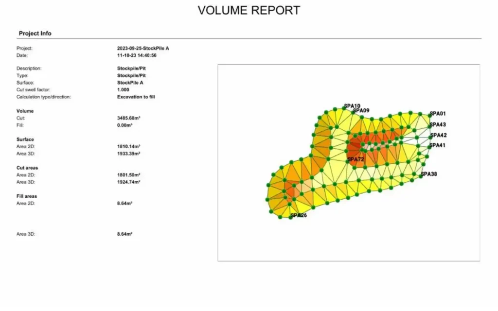
b. Volume Calculation Method: I calculate the volume using appropriate software or methods such as the trapezoidal rule, grid-based calculations, or 3D surface modeling. The choice of method depends on the data I’ve collected and the software at my disposal.
4. Quality Control:
Accuracy Check: I ensure that my survey data is accurate and the volume calculation is consistent with my survey objectives.
Accuracy is at the heart of what I do. Mistakes can be costly in construction, so I take extra care to ensure my measurements are as precise as possible. It’s not just about measuring; it’s about measuring right.
5. Reporting:
a. Introduction: I begin the report with an introduction that includes the purpose of the survey, location details, and the date of the survey.
b. Methodology: I describe the surveying methods and equipment I used, as well as any control points I established.
c. Data Presentation: I provide visual representations of the stockpile, such as contour maps, point cloud images or 3D models.
d. Volume Calculation: I present the calculated volume of the stockpile, including any assumptions I made during the calculation process.
e. Discussion: I discuss any challenges, limitations, or discrepancies I encountered during the survey.
f. Conclusion: I summarize the key findings of the survey and emphasize the accuracy and reliability of the volume determination.
g. Recommendations: If necessary, I provide recommendations for managing the stockpile, such as excavation, storage, or redistribution of soil materials.
h. Appendices: I include any additional data, photos, 3D drawings, or supplementary information.
My Services Covering Area:
Lincolnshire:
Lincoln
Grimsby
Scunthorpe
Grantham
Boston
Spalding
Yorkshire:
Leeds
Sheffield
York
Bradford
Kingston upon Hull
Huddersfield
Middlesbrough
Nottinghamshire:
Nottingham
Mansfield
Beeston
Carlton
Sutton-In-Ashfield
West Bridgford
Leicestershire:
Leicester
Loughborough
Hinckley
Melton Mowbray
Coalville
Lutterworth
Derbyshire:
Derby
Chesterfield
Swadlincote
Ilkeston
Long Eaton
Buxton
Cambridgeshire:
Cambridge
Peterborough
Huntingdon
Ely
St. Neots
Wisbech